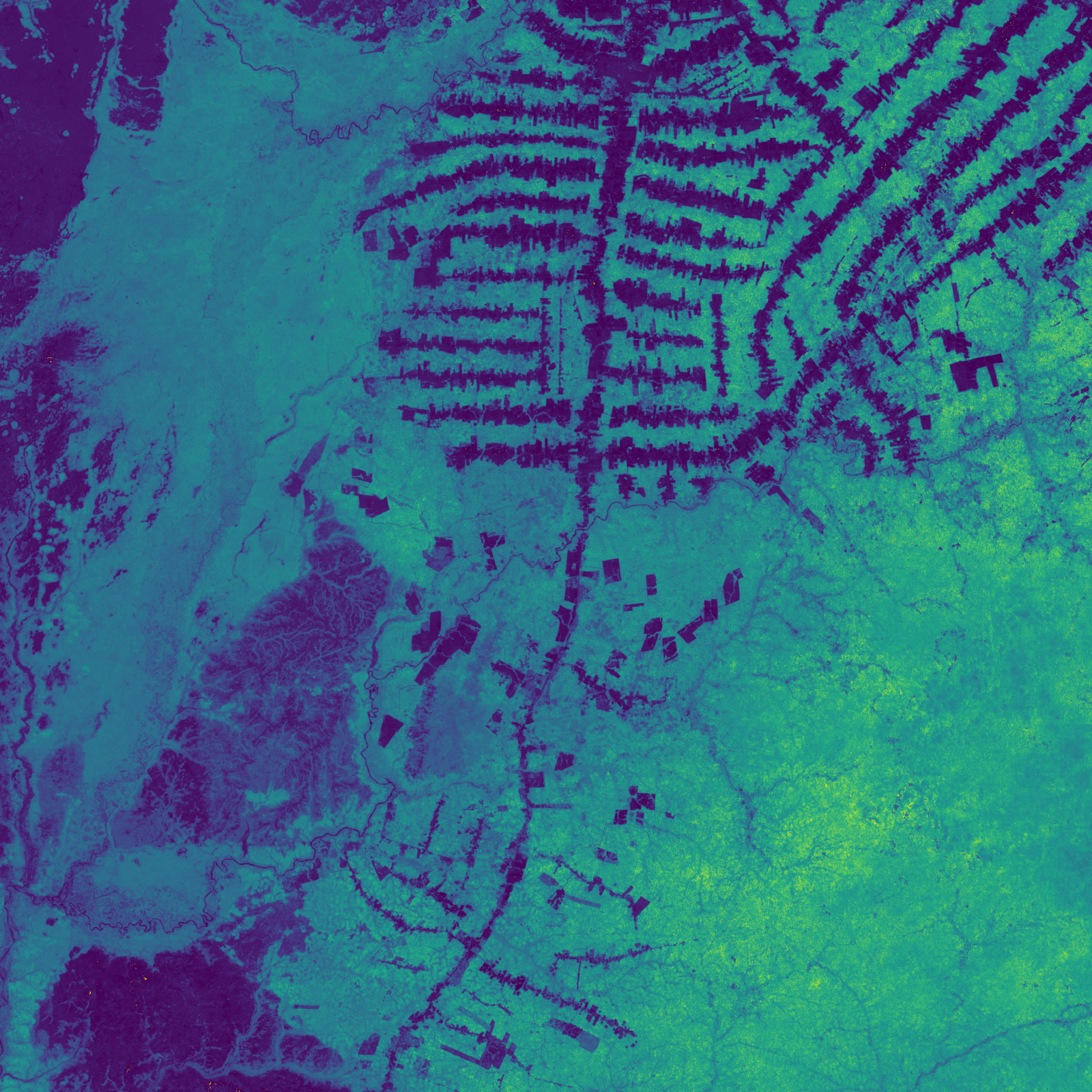
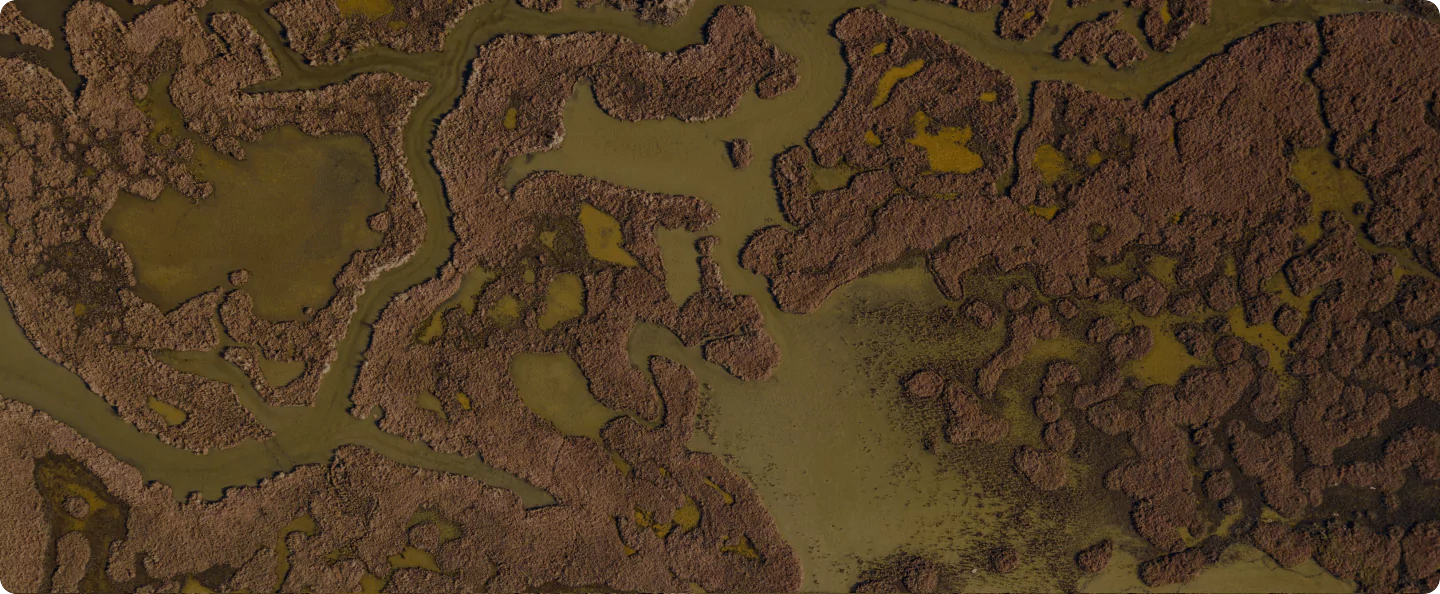
Forest topography overlaid with various carbon measure visualizations

At Pachama, we believe in harnessing the power and efficiency of commercial markets to address climate change at scale. Given the massive problem of climate change — it’s vital to identify and invest in solutions that work.

By using technology to make the market for forest carbon credits more transparent and accessible, we are empowering individuals and businesses to make smart choices about the climate solutions they support.

Not all forest projects are equal. While some drawdown substantial carbon and offer wide-ranging ecosystems and social benefits, others offer only negligible or disputed carbon benefits over what might have otherwise happened. That’s why we rigorously evaluate each forest project before deciding whether to list its carbon credits on the Pachama platform.

The framework

The framework we use for evaluating projects at Pachama follows UN frameworks, although we put our own remote-sensing, data-driven spin on it. We examine each project through the following lenses:

  1. Real
  2. Additional
  3. Permanent
  4. Verifiable
  5. Enforceable
  6. Impactful beyond carbon

Let’s break down what each of these words means and illustrate how Pachama uses remote sensing data, machine learning models, and data from project developers to evaluate how well each project meets these standards.


Real

First, we check whether or not a project is real. To do this, we take the project boundary provided by the project developer and overlay it on remote sensing data to see whether there is indeed a forest project at that location. While most projects pass this basic test, there have unfortunately been instances where projects do not have clear boundaries of the forests they are protecting, so we can not validate all the claims of the project.

Additional

Once we have determined that a project is real, the next question we need to answer is whether the project provides additional carbon benefits over what might happen if the project didn’t exist.

Pachama evaluates additionality by comparing the forest stock within the project boundary to that of forests in the surrounding area using historical remote sensing data. If the forest within the project shows better trends than unprotected forests nearby, the carbon benefits are additional and the project is having a real impact on protecting carbon. However, if there is no meaningful difference between the rate of deforestation or the rate of regrowth inside and outside of the project boundaries, the project can’t fairly claim that it is doing something different to deserve carbon credits.

Additionality problems look different for different types of forest projects. A reforestation project will have low additionality if there is no more regrowth happening within the project than is already happening in the area thanks to market forces. An avoided deforestation project will have low additionality if it is being deforested just as fast as the surrounding region, or if it has little to no risk of being deforested at all because it is far away from a road or any recorded deforestation.

On the left, an avoided deforestation project with high additionality given it is right at the edge of deforestation (seen in blue). On the right, a similar conservation project with poor additionality given it is an area with no deforestation happening.

When evaluating additionality, we put the remote sensing data into context by considering what efforts a project is taking to protect or restore forests — are they investing in security to protect against illegal logging? Are they actively planting trees? Are they harvesting timber less frequently than previously? These efforts show how motivated and capable the project is of actually protecting or restoring the forest.

In addition to examining projects for an impact beyond business-as-usual for the region, we also use the remote sensing analysis to look for any signs that the project’s existence is causing harmful effects next door (commonly called leakage in the carbon credit world). While remote sensing can’t catch all the potential ramifications, we can see if there is any evidence of leakage in the surrounding region.

Permanent

Permanence refers to how long the carbon benefits of a project are likely to last. Trees do not capture and store carbon indefinitely. When a tree dies, it stops absorbing carbon, and when it burns or decomposes, the carbon stored within it is released back into the atmosphere. While the typical growth and death of individual trees within a forest do not threaten the overall permanence of carbon benefits within that forest, damage or destruction of the forest itself will rapidly reverse carbon benefits.

Pachama evaluates permanence by considering the risk of forest damage from natural causes or human activity as well as the project’s plans to prevent or mitigate potential damage.

We overlay project regions with geographic analysis of forest fire or pest risk, and work with project developers to understand any risk reduction measures. When assessing deforestation risk, we consider both remote sensing data showing historical deforestation trends in the area as well as the project’s ability to protect against deforestation in the long-term.

Land ownership status, project timeframe, and resources for protecting against illegal deforestation all play a role in assessing deforestation risk. A project with a long-term conservation easement that legally restricts activities on the property even if it is sold may be considered more permanent than a project located on property owned by a timber company who is likely to sell the land in 20–30 years. Similarly, a project with adequate resources to fund monitoring and security staff may be considered more permanent than a project that lacks adequate planning or resources to prevent illegal deforestation.


Verifiable

To include the project on our platform, we need to verify both the actual number of carbon credits issued as well as the carbon benefits they are meant to represent. First, we check whether the project and its carbon credits have been properly documented and verified by a third-party verification organization. Then, we use remote sensing data and machine learning models to quantify the amount of additional benefit and compare that to the volume of carbon credits the project is offering.

Images of the biomass of Fazenda Sao Nicolao, a reforestation project in the Amazon doing great work to regrow native species in previous cattle fields. On left is the project in 2000 and on the right in 2019 where the increasing green shows the measurable carbon stock growing on the property.


We do this by comparing the biomass — and therefore of stored carbon — inside and outside of the project boundaries to estimate the net carbon benefit of the project within its lifetime. Compared to traditional ground-based verification, Pachama’s method is much faster because it uses aerial data to measure the entire forest rather than extrapolating from a sample of manual measurements.

If we find that the project significantly overestimates carbon benefits or does not clearly count the number of credits being offered, we won’t include it on our platform.

Example of a Pachama analysis measuring biomass changes in one of our forest projects due to tree growth. We can use this growth to understand carbon sequestration and compare to the number of credits issued, and one day plan to help landowners and project developers issue credits using these remote tools.

Enforceable

The carbon credits associated with projects on Pachama must be enforceable, meaning that their sale and purchase must be tracked so that they cannot be fraudulently double-counted or sold twice to different purchasers. To ensure that projects are enforceable, we only include those carbon credits that are tracked in one of the top four registries, all of which have defined rules and tracking mechanisms to enforce the integrity of carbon credits.

Impactful beyond carbon

Finally, we consider how forest projects interact with the local community and the surrounding ecosystem. Besides being great carbon sinks, forests provide a home for astounding biodiversity, supply ecosystem services like water filtration and storm protection, and create new economic options.

Remote sensing today can not tell us the full picture (although Pachama is working on increasing the innovation in remote wildlife mapping), so we work closely with project developers to understand what is happening on the ground. Community consultation and involvement is vital for the long-term success of any project, and it promotes climate equity by empowering local communities and creating forest-based economic opportunities.

Our platform includes information about the benefits of each forest project to you so that you can choose to purchase carbon credits from the projects that best align with your goals and values.

Brazil Nuts Concessions is an example of a project working with small landowners and the local community in Peru, with a focus on creating new models for landowners to derive economic value from protecting the forest, like harvesting Brazil nuts. (Photo Credit: BAM)

Weighing all factors together

After we score to what extent a project has real, additional, permanent, verifiable, and enforceable carbon credits, we then weigh and consider these factors together to decide whether to include the project on our platform. There are few “perfect” projects, and so we often must consider trade-offs. For example, an avoided deforestation project in an area with active deforestation may have higher permanence risk due to illicit logging. But if the benefit of high additionality outweighs the risk, we will consider the project worthwhile and include it on the platform. Today, we exclude about one third of all projects we review so that you can choose from only those projects that we assess to be providing meaningful carbon benefits.

But you don’t have to take our word for it — you can evaluate projects for yourself by exploring project maps and data on the Pachama platform.

Ready to start exploring? Explore Pachama today to learn more about the forest projects or contact us to find out more about our approach and how we can help you achieve your goals.

The creation of a thousand forests is in one acorn Ralph Waldo Emerson